
Sarasota Neighbors by Block
A block search should begin with geography, not names. The Sarasota County Property Appraiser map shows the subject parcel and touching lots. Its property cards identify owners, mailing addresses, parcel numbers, legal descriptions, exemptions, sales, and building facts. The city permit and neighborhood maps add project and civic-boundary context. A voter extract can add nonexempt registrants, but the public self-lookup cannot enumerate a street. Historic reverse directories are the address-first source for a past block.
| Source | What It Shows About a Block | Access |
|---|---|---|
| Parcel GIS | Parcel shapes, nearby lots and links to owner cards | Free map browsing |
| Assessment roll | Owner, tax mailing address, situs, exemptions and sales | Free property search |
| Voter extract | Nonexempt registrants sorted by residence or precinct | Chapter 119 request |
| Permit and code records | Projects, owners, agents, cases and dates by address | City portal and department request |
| Neighborhood GIS layer | Named association boundary | City interactive map |
| Historic reverse directory | Listed occupants in house-number order | History Center; offsite volumes |
Ownership and occupancy are different claims. A matching mailing and situs address plus a homestead exemption supports owner occupancy, but it does not prove who else lives there. A different mailing address may identify an absentee owner, trust, manager, or simple mailing preference. Apartment parcel cards often name one entity for the entire property. They do not reveal unit residents.
The Sarasota County Property Appraiser hub is the first visual source for a modern block.
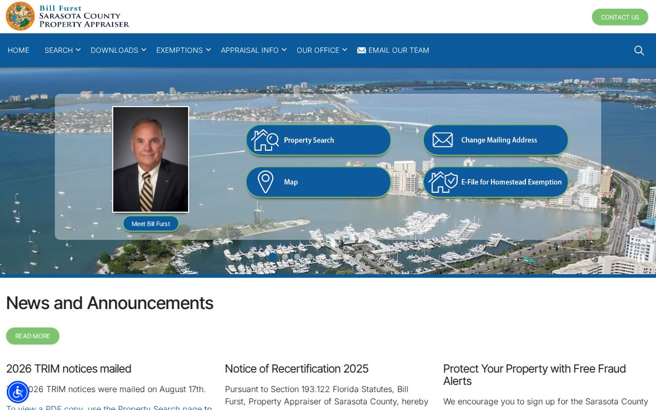
The page links the roll and mapping tools needed to move from a known address to nearby parcels while keeping owner data distinct from resident claims.
Sarasota Neighbor Geography
Three boundaries can overlap without matching: the City of Sarasota, Sarasota County, and the postal place called Sarasota. A 34243 mailing address can lie in Manatee County. Siesta Key and Palmer Ranch use Sarasota mailing names but generally rely on county rather than city records. Check the parcel first, then choose the custodian.
Neighborhood association lines add a fourth geography. They organize civic participation, not mail delivery or property ownership. An HOA boundary is different again and may follow a recorded private declaration. The city instructs users to enable the Neighborhoods layer in its interactive map. That layer supplies the current civic boundary, while the assessor map supplies parcel facts.
Geography tip. A Sarasota mailing line does not establish city jurisdiction; verify county, city limits, and association boundary separately.
Map Sarasota Neighbors Nearby
The dependable Sarasota method uses manual adjacent clicks because a radius or buffer tool is not consistently exposed across the county's ArcGIS applications. Start at one verified address and move lot by lot. Keep a simple list of parcel number, situs, owner label, mailing city, and the date checked. Reset each popup before clicking the next parcel so facts from two lots do not get mixed.
- Open the Property Appraiser Map Property Search and locate the known address. Zoom until parcel outlines are clear.
- Click the subject polygon. Save its parcel number and property-card link before moving to each touching or nearby polygon.
- Open each parcel card. Compare situs, mailing address, exemptions, property use, and sale date without treating any one field as a household roster.
- Turn on the relevant county or city layer for neighborhood, zoning, flood, or district context. Those layers describe place, not identity.
- When the task expands beyond the immediate block, use the Sarasota street directory workflow for the whole named street.
This flow produces a defensible parcel list, not a list of every neighbor. Owners can live elsewhere. One owner can hold several nearby lots, and a corporate owner may provide no resident name at all. Use permits, public voter data, or a dated reverse directory only for the narrower fact each source actually states.
Sarasota Neighbors in Voter Data
Florida registration records can include name, residence address, date of birth, party, phone, email, status, precinct, districts, mailing address, and election participation. Participation means that an election was credited, never how someone voted. Section 97.0585 withholds Social Security numbers, driver-license or state-ID numbers, application source, and copies of voter signatures. Protected voters can have more location fields withheld.
The county's My Voter Record form requires name and date of birth and is intended for a voter checking an individual record. It is not a browse-by-block tool. A block-level set requires a public-record request to the Supervisor of Elections. Ask for a specific snapshot date, geography or precinct, fields, electronic format, and removal of exempt records. The office accepts requests online, by email, mail, fax, phone, and in person.
Even a properly released extract omits children, noncitizens, unregistered people, and protected records. Former registrations may lag a move. Use it as a dated layer beside parcel evidence, never as a full list of nearby residents.
The operative Florida inspection and copying rule is reproduced through the official legislative site.
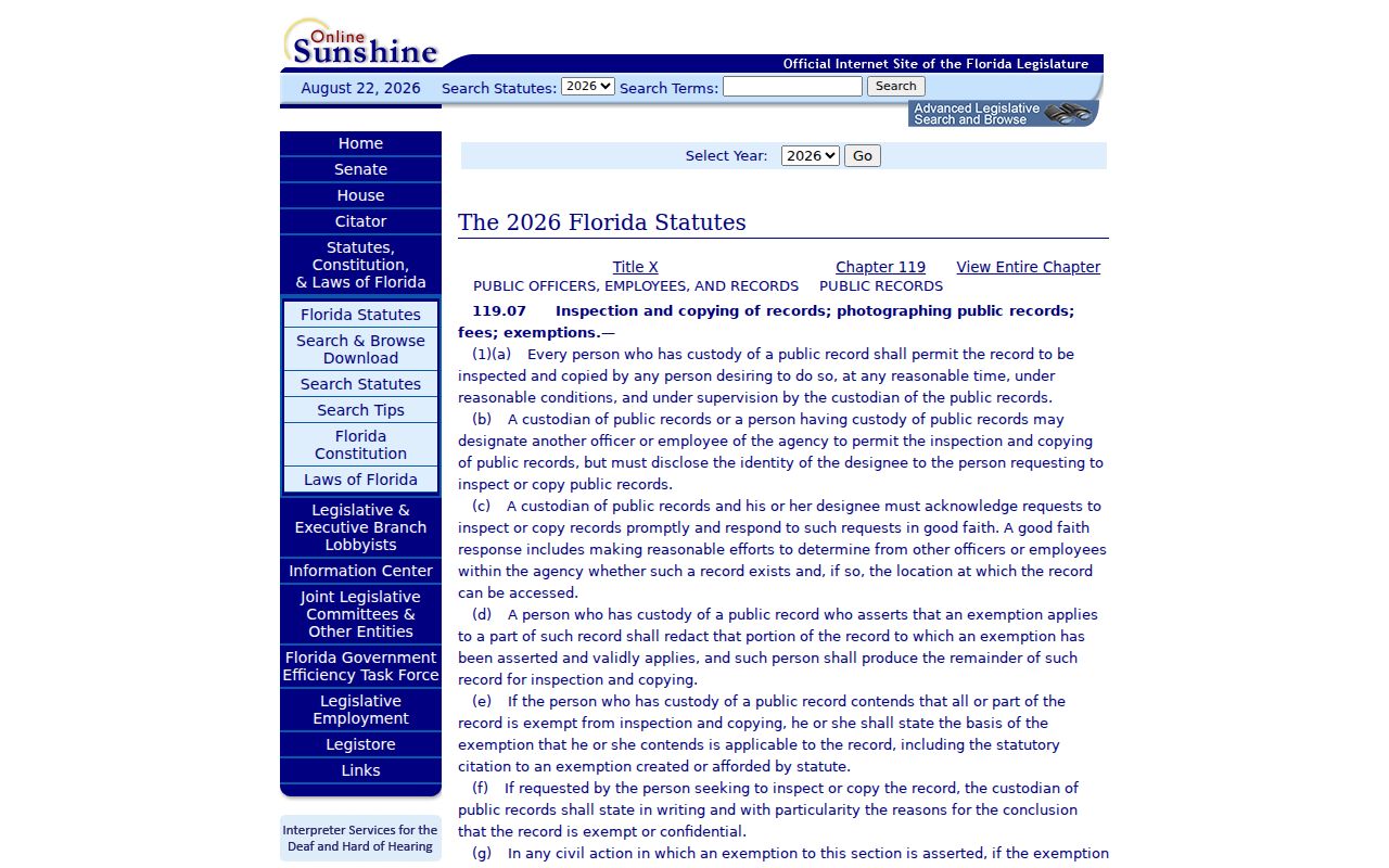
The statute supports access to nonexempt agency records while preserving the redaction and fee rules that apply to a voter extract.
Sarasota Neighborhood Associations
The City of Sarasota publishes association boundaries and participation contacts, not a certified membership roster. Associations are voluntary civic groups. Active groups commonly hold meetings, maintain leadership, communicate with residents and city staff, keep governing articles, and define a service area. People and local businesses in that area may take part, but living within a mapped boundary does not prove membership.
| Area group shown in city materials | Local context | How to verify |
|---|---|---|
| Gillespie Park, Rosemary District, Downtown | Central and early-city areas | Current Neighborhoods GIS layer |
| Newtown, Bayou Oaks, Central Cocoanut | North Sarasota civic areas | City map and planning contact |
| Alta Vista, Arlington Park, Laurel Park | Central and east-central neighborhoods | Current boundary and group status |
| Indian Beach-Sapphire Shores, Lido Key, St. Armands | Bayfront and island areas | City map, not postal ZIP alone |
| Southside Village, West of Trail, McClellan Park | South and west-of-trail civic areas | Neighborhoods GIS and city contact |
Boundaries and group status can change. Confirm them through Neighborhoods@SarasotaFL.gov. HOA membership is a separate private matter usually tied to a declaration. Congregation, club, and block-watch rosters are also voluntary or private unless the group chooses to publish them.
Note: Ask an association for its own public contact material; do not assume the city holds or must create a private member list.
Sarasota Blocks Through Permits
City permit records add activity to parcel facts. The search accepts owner, contractor or agent, street number, bare street name, parcel ID, city, and postal code. Sarasota's form specifically tells users to omit the directional prefix, suffix, and street type from the street-name box. That local quirk can recover results missed by a fully formatted address.
A permit can show a project address, owner attached to the application, contractor, work description, status, and timing. It does not prove that an owner or contractor lives there. The city also warns that some residential permit data before 1997 may be missing online. Request the older permit jacket or archived file from Development Services when the portal stops short.
Code-compliance records may identify an address, respondent or owner, inspector, violation, hearing, and lien outcome. Use the city portal, notices, or a narrow department request. These records describe a property matter on the block, not every household nearby.
Earlier Sarasota Neighbors
For a past block, Hill-Donnelly directories reverse the search: street name, ascending house number, then listed occupant or business and sometimes a phone. Sarasota County History Center stores these volumes offsite, so request them at least three business days before an Osprey visit. Exact year runs were not published online and should be confirmed with staff.
Polk directories are usually name-first, though some editions contain street sections. The local documented run spans selected years from 1918 through 1999 with gaps. Older maps, permits, and plats help bridge changed display addresses. Sarasota's 1921 county creation also matters because earlier land and court research can lead to Manatee County.
Reverse directories list subscribers or surveyed occupants, not every person. Seasonal residents may vanish between editions, and a listed name can remain after a move. Pair the entry with a dated newspaper, census, deed, or probate file before treating it as proof of who lived on the block.
Sarasota Neighbor Source Comparison
Official records and commercial neighbor tools answer different questions. Government rolls identify the custodian, date, field meaning, and exemption rules. Commercial compilations combine many feeds and may merge people, preserve stale addresses, or hide the original date. They can suggest a lead, but the public source should settle the fact.
| Source type | Strength | Main limit |
|---|---|---|
| Official parcel and assessment rolls | Current owner and parcel facts from the custodian | Owners are not all occupants |
| Official voter extract | Dated, nonexempt registration fields | Not a complete household roster |
| Association contact material | Current civic group and boundary context | Voluntary, not government-certified membership |
| Commercial compilation | Broad lead gathering | Source dates, merges, and accuracy may be unclear |
A sound neighbor lookup stays narrow. Record what the custodian says, note the date, and leave absent people absent. Never infer a renter, child, partner, or household member from the parcel owner's name.
Sarasota Neighbors and Privacy
Florida's public-record rules do not make every nearby person visible. The federal Driver's Privacy Protection Act restricts motor-vehicle address data. Utility customer information cannot be assumed public. The Attorney General's Address Confidentiality Program gives qualifying survivors a substitute address and agency nondisclosure process. Section 119.071 also shields defined fields for eligible high-risk professionals and families.
Owners, voters, permit applicants, and directory subscribers are only parts of the block. Each list has a different date and purpose. A missing name may reflect a renter, a move, a protected address, lack of registration, an unlisted phone, or a record that remains offline. Do not work around a lawful privacy barrier.
Lawful use. Neighbor records support civic curiosity, reconnection, and personal safety. Florida law prohibits stalking, harassment, threats, intimidation, and harm.